
Fun & Factopedia logoFun & Factopedia
Homeβ€ΊArticlesβ€ΊThe 390-Million-Year-Old Crater Discovered on Google Maps

Meteor Impact Craters

The 390-Million-Year-Old Crater Discovered on Google Maps

A camping trip led to one of the internet's most fascinating discoveries. While exploring Google Maps, an outdoor enthusiast noticed a perfectly circular formation hidden deep within Quebec's wilderness. Scientists later confirmed it was an ancient meteor impact crater nearly 390 million years old.

🟒 editors-pick⏱ 3 min readVersion 1.0
Fun & Factopedia featured image

Confidence

🟒 editors-pick

Published

July 2026

Last Updated

July 2026

Version

1.0

⚑ Quick Answer

The Uhaachatik Impact Crater is an ancient meteor impact structure located in northern Quebec, Canada. Estimated to be about 390 million years old and roughly 16 kilometers (10 miles) in diameter, the crater remained largely unknown outside scientific circles until it gained attention after being noticed on Google Maps by a camping enthusiast. Although geologists had previously documented the crater, the story highlighted how satellite imagery allows anyone to spot remarkable geological features from home.

Did You Know?

  • β—Ž The Uhaachatik Impact Crater is approximately 390 million years old.
  • β—Ž It is about 16 kilometers (10 miles) wide.
  • β—Ž The crater is located in northern Quebec, Canada.
  • β—Ž Millions of years of erosion softened its original crater walls.
  • β—Ž Satellite imagery makes its circular shape much easier to recognize than viewing it from the ground.

Full Story

The 390-Million-Year-Old Crater Discovered on Google Maps

Sometimes...

one of Earth's greatest discoveries is hiding in plain sight.

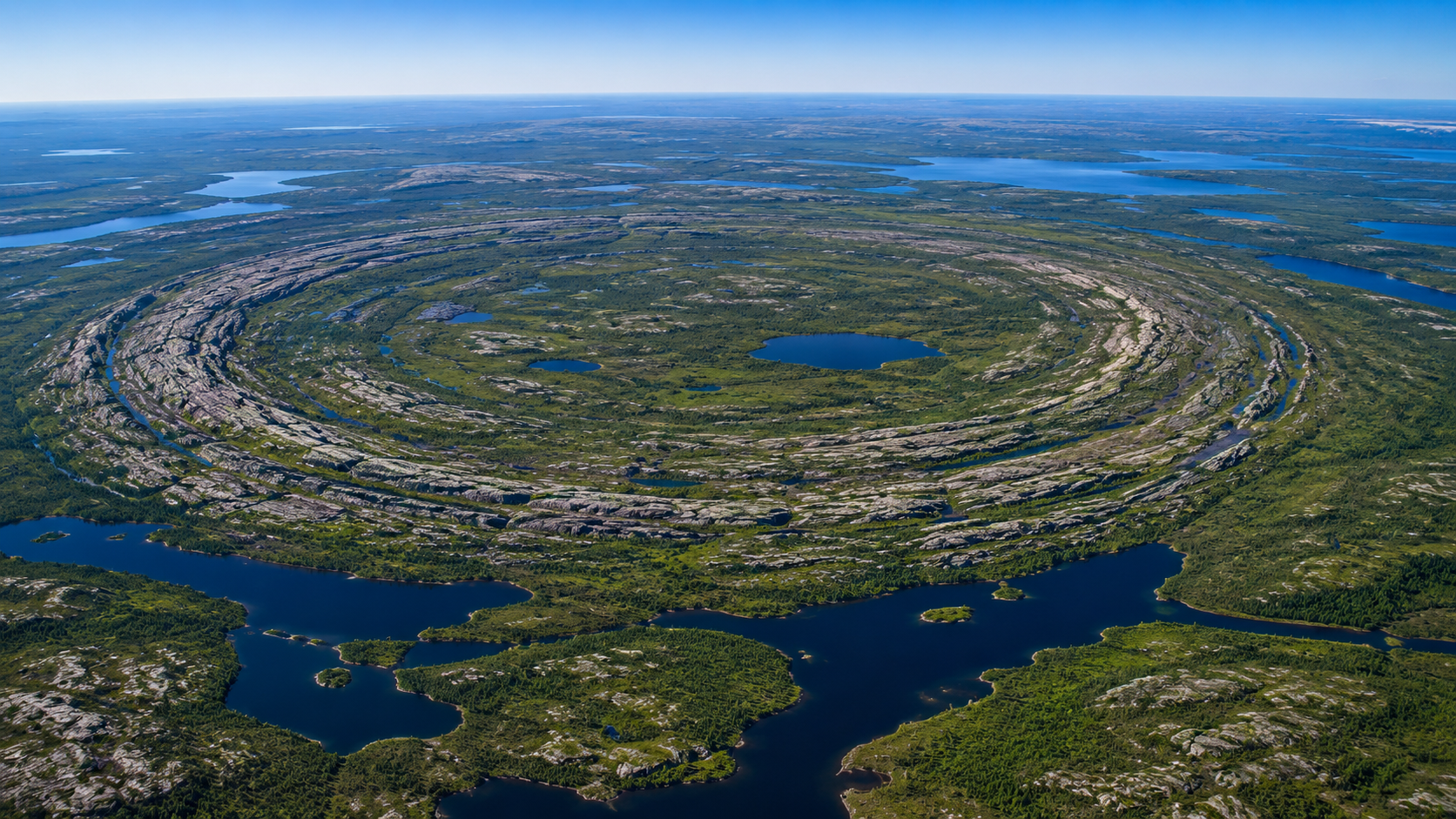
While planning a camping trip using Google Maps, an outdoor enthusiast noticed an enormous circular formation deep within the forests of northern Quebec.

Curious about its unusual shape, he shared his discovery online.

An Ancient Impact

Scientists identified the formation as the Uhaachatik Impact Crater, an ancient scar left behind by a meteor that struck Earth approximately 390 million years ago.

The crater measures about 16 kilometers (10 miles) across.

Although geologists had already documented the crater, the online discovery introduced millions of people to a geological feature that few had ever heard of.

Why Is It So Easy to See?

Over hundreds of millions of years, erosion removed the original crater walls.

However, the surrounding rocks weathered differently, leaving behind a remarkably circular landscape that is still visible from satellite imagery.

From ground level, the formation is difficult to recognize.

From space, its nearly perfect ring stands out clearly.

Google Maps Meets Geology

Modern satellite imagery allows anyone with an internet connection to explore some of Earth's most fascinating landscapes.

Professional scientists still perform the detailed research, but tools like Google Maps have made geology more accessible than ever.

A Reminder From Deep Time

Long before humans walked the Earth, enormous meteor impacts helped shape our planet.

Today, ancient craters like Uhaachatik remind us that the Earth's surface preserves stories stretching back hundreds of millions of years.

Sometimes...

all it takes is looking at the world from a different perspective.

FAQ

What is the Uhaachatik Impact Crater?

An ancient meteor impact crater located in northern Quebec, Canada.

How old is the crater?

Scientists estimate it formed about 390 million years ago.

How large is it?

Approximately 16 kilometers (10 miles) in diameter.

Was it actually discovered on Google Maps?

The crater was already known to geologists, but it gained widespread public attention after someone noticed its distinctive shape while browsing Google Maps.

Why is the crater still visible?

Different rock layers eroded at different rates, preserving the crater's circular outline.